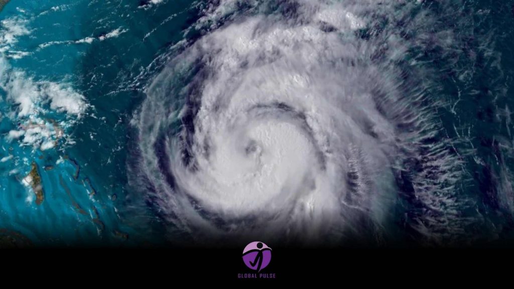
The 2024 Atlantic hurricane season is nearing its conclusion, and it has been notably active throughout.
So far this season, 18 tropical storms have been named, with 11 escalating to hurricane strength. Five have qualified as major hurricanes, categorized as level three or higher.
A standard season is typically expected to produce 14 storms, including seven hurricanes and three major hurricanes.
Certain records have been matched or surpassed throughout the season; however, weather was inconsistent across the entire timeframe. Interestingly, the season’s midpoint, typically the peak, experienced an unusual calm.
A vibrant beginning
Pre-season forecasts indicated that this season was expected to surpass average levels, with some predictions labelling it as “extraordinary.”
Early indicators suggested that the season would meet high expectations, as Hurricane Beryl made history on July 2 by becoming the Atlantic’s earliest recorded category-five hurricane.
The storm inflicted extensive damage and resulted in multiple fatalities throughout the Caribbean before making landfall along the southern Texas coast, leading to significant flooding and power outages in both Texas and the adjacent state of Louisiana.
Following the dissipation of Beryl, the Atlantic experienced a period of calm.
A pause in the proceedings
The hurricane season spans from June 1 to November 30, with activity generally peaking in early September. Following Beryl in July, the Atlantic experienced a lull, with only four named storms and no significant hurricanes reported until the formation of Helene on September 24.
The unexpected nature of this quiet period caught many off guard.
Warm oceans drive hurricanes, with sea surface temperatures in the tropical Atlantic remaining consistently above average.
The conclusion of El Nino, a phenomenon known to inhibit hurricane formation, is anticipated to increase storm activity.
The formation of hurricanes involves a complex interplay of various factors that create these powerful storms.
A recent analysis suggests that changing weather patterns in Africa, which resulted in unusual rainfall in the Sahara, may have caused clusters of thunderstorms that typically generate tropical systems to form further north in the Atlantic. This shift occurred in a region that is generally less conducive to development. Significant quantities of Saharan dust may have contributed to a reduction in activity.
However, elevated sea surface temperatures persisted, indicating a continued risk for the formation of powerful hurricanes.
The Atlantic makes a striking resurgence
The emergence of Hurricane Helene in late September marked the realization of this potential. The storm intensified swiftly, making landfall on the Florida coast as a significant category-four system.
Helene unleashed devastating flooding and extensive wind damage throughout significant areas of the southeastern United States, impacting regions from Florida’s Gulf Coast to the southern Appalachians.
Preliminary data from the US National Oceanic and Atmospheric Administration (NOAA) indicates that this hurricane has become the deadliest to strike the continental US since Hurricane Katrina in 2005, resulting in over 150 fatalities.
Helene emerged as the initial storm in a rapid series of six that formed quickly. Five developed into hurricanes, with four experiencing rapid intensification, characterized by a sustained wind increase of at least 35 mph (56 km/h) within a 24-hour period.
The event peaked with Hurricane Milton, which emerged in the Gulf of Mexico in early October. The storm experienced a staggering increase in wind speeds, escalating by 90 mph (145 km/h) within just 24 hours—marking one of the most significant instances of rapid intensification documented.
The storm briefly intensified to category five status before diminishing to category three as it approached the west coast of Florida for landfall. The event resulted in significant consequences, featuring a devastating storm surge and a notable outbreak of 46 tornadoes.
Tropical Storm Sara marked the conclusion of the Atlantic storm season. The storm failed to intensify into a hurricane; however, it adopted a slow-moving trajectory near the coast of Central America, resulting in extensive flooding across the region. More than 3 feet (nearly 1 meter) of rain fell on the north coast of Honduras.
Could climate change be the culprit?
Recent BBC analysis, utilizing data from the European Climate Service, reveals that high sea temperatures significantly influence the formation of tropical storms and hurricanes. These temperatures have been approximately one °C above the average recorded between 1991 and 2020.
This observation aligns with a broader global trend of rising ocean temperatures driven by climate change.
According to an analysis conducted by Climate Central, external factors have contributed to increased maximum wind speeds in every Atlantic hurricane of 2024, a phenomenon linked to climate change. Hurricane Milton exhibited winds that were 23 mph stronger, a phenomenon attributed to human-induced global warming.
Recent analysis reveals that climate change has significantly amplified the exceptionally high sea temperatures contributing to the storm’s intensity, with estimates suggesting a likelihood increase of 400 to 800 times.
A recent study conducted by World Weather Attribution reveals that climate change has led to a 20-30% increase in rainfall in Milton.
According to scientists, the overall frequency of tropical cyclones and hurricanes is not expected to increase globally. However, the events that occur are expected to escalate more quickly and produce more significant amounts of rainfall, thereby increasing their potential danger.


